
The Annapurna region is an area in western Nepal where some of the most popular treks are located. The region is generally taken to include areas around the Annapurna Range (Annapurna Himal), the Dhaulagiri Range and the Kali Gandaki River valley. Peaks in the Annapurnas include 8,091m Annapurna I, Nilgiri (7,061 m) and Machhapuchchhre (6,993 m). Dhaulagiri I (8,167 m) is just to the west of the Annapurnas, Most of these peaks are visible throughout the region on clear days.
Annapurna is a subrange of the Himalaya. Annapurna I reaches 8,091 m (26,538 ft), making it the 10th-highest summit in the world, one of fourteen over 8000 meters in the Himalaya and Karakoram ranges. It extends east from a huge gorge cut through the Himalaya by the Kali Gandaki River to the Marsyangdi River. The Dhaulagiri Range rises west of the Kali Gandaki. 8,167 m Dhaulagiri I is only 34 km from Annapurna I, making the valley between over 6,000 m deep.
Annapurna is a Sanskrit name, literally “full of grain” which can also be translated as “Goddess of the Harvests”. She is an avatar (alternative form) of the goddess Durga.
The Annapurna Conservation Area is also located in the region.
Among the popular treks in the region are the Annapurna Circuit trek which circles the Annapurna Range, the Kali Gandaki River Valley trek which brings you up the world’s deepest valley and the Annapurna Sanctuary Trek up to the Annapurna Base Camp. There are many more trails for shorter treks. The region includes the Trans-Himalayan areas north of the main Himalayan Ranges, where the land is arid and the culture more Tibetan than Hindu.
The Annapurna region, as travellers know it, is not an administrative region. The area is located in two zones – Gandaki and Dhaulagiri. The districts in the Annapurna region are Baglung, Kaski, Lamjung, Manang, Mustang and Myagdi.
Mustang (pronounced as “Moo stung”) is located in the western part of Nepal and is officially the name of the district having a Tibet like region. The area is divided into two parts: Upper Mustang and Lower Mustang. Upper Mustang is largely occupied by Manangi people and goes up to the ancient capital of Lo Manthang. Whereas Lower Mustang covers the part of lower valley along the Kali Gandaki river. Mustang is the only district in Nepal with its own King. The citizens of Mustang call themselves Lobas. “Mustang” is a Tibetan lost valley and stands as a hidden treasure of Nepal. A vast breadth of rock; wilderness of huge proportions, Mustang opened only for selected organized groups since 1992. Mustang offers a truly outstanding opportunity to travel around an area rich in ancient tradition and mythology. An almost treeless, barren landscape with a countryside similar to Tibetan plateau. In lower Mustang the hills tend to be great, red fluted cliffs, while upper Mustang offers an endless expanse of yellow and gray rolling hills, eroded by the wind, which is prevalent in this area. The trek takes you to the walled town of Lo-Manthang, a visually extraordinary place, home of the present Mustang’s King and full of beautiful temples and a Gumba.
Cities of Annapurna region
- Chitre
- Chomrong– A village on the way to Annapurna Base Camp with stunning views of the Annapurnas and Machapuchre.
- Ghasa – guesthouses & restaurants at upper end of the Kali Gandaki’s steep gorge between the Annapurnas and Dhaulagiris. You will have wonderful Nepali-village hotels here. If you stay here, you can see wonderful natural sights and village life of Nepal. It is better to use only locally produced foods as much as possible as this will contribute more to improve the local economy.
- Ghorepani – “Horse Water” – guesthouses; the high point on the way to Tatopani on the Kali Gandaki River from Pokhara. Base for day trips to Poon Hill. Poon Hill Tower is about 30 minutes upward from Ghorepani.
- Jomsom – Often used as the end (or, less commonly, the start) of the Annapurna Trek. It has an airport with a paved runway with service to Pokhara. Most basic services can be found here with trekker hotels near the airport. Bus travel south to Pokhara is also available (NPR300 for Nepali and NPR600 for foreigners).
- Kagbeni – monastery in Kali Gandaki valley half-a-day from Jomsom
- Kalopani – guesthouses & restaurants
- Larjung
- Manang – usual stopping point for elevation-acclimation on the Annapurna circuit trek.
- Marpha – half a dozen guesthouses and restaurants, and a small store with basic supplies; center of apple growing in the region.
- Muktinath – Between the upper valley of the Kali Gandaki and the Annapurna Range, this pilgrimage objective has 108 fountains where the faithful bathe and perpetual flames fed by natural gas. This region is also famous for Shaligrams – fossil ammonites said to be a manifestation of the god Vishnu. If you are coming down from the Thorung La, this village has some decent accommodation and good food. It is pilgrimage site for Buddhists and Hindus high above Kali Gandaki valley several kilometers and 1700 m in elevation below the Thorong La pass from Manang. Jomsom to Muktinath bus fee: NPR150 (for Nepali), NPR300 (for foreigners).
- Humde – Manang’s airport, an hour or two walk east of Manang.
- Tatopani – “Hot Water” – named for its hot springs; several hotels by the river at the lower end of the Kali Gandaki’s steep gorge through the main Himalayan range. Entrance Fee for hot bathing: for Nepalese: NPR10, foreigners: NPR40.
- Tirkhedunga – guesthouses
- Tukuche – Center of Thakkali culture, important trading village, hotels and restaurants.
- Ulleri – guesthouses; second-night stopping point for Jomsom trek
Similar place
Manaslu is the eighth highest mountain in the world. The two-week Manaslu Circuit Trek receives around 2,000 visitors per year which is small compared to Annapurna or Everest. The trek is similar in many ways to the Annapurna Circuit in that it circumnavigates the peak of Manaslu, travels a long steep, verdant river gorge (the Buddhi Gandaki River), encounters glaciers and other spectacular high-mountain scenery. Only recently in 2010 were enough tea-houses built so that trekkers could complete the circuit without camping. It is now a tea-house trek, though some lodges on the way are still very simple compared to their present-day Annapurna counterparts. Some liken it to the Annapurna Circuit as it used to be in the past. The trek can be done almost all year round, though it is very cold from late December to February and too hot and hazy in May to be pleasant. Unlike the Annapurna Circuit the Manaslu Circuit Trek requires USD50 Restricted Area Permit (RAP) which requires that trekkers be in a group of two or more and travel with a guide. This is mainly due to the proximity of the area to the Tibetan border. Trekkers must also pay a Manaslu Conservation Area entrance fee of NPR2000.
Namaste
“Namaste” is the greeting word in Nepali. People greet others with this word and expect it in return. People along the trail generally can understand English but might not reply fluently.
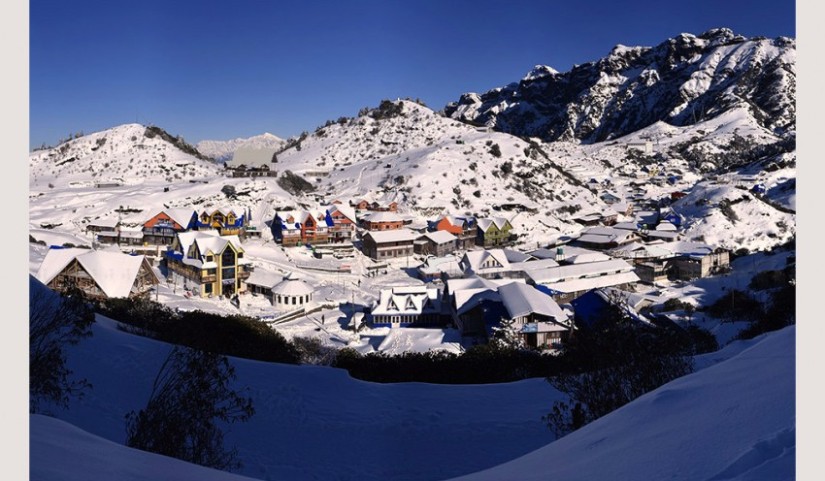 This is the Gaurishankar Conservation Area.


You must be logged in to post a comment.